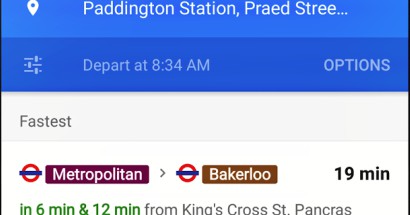
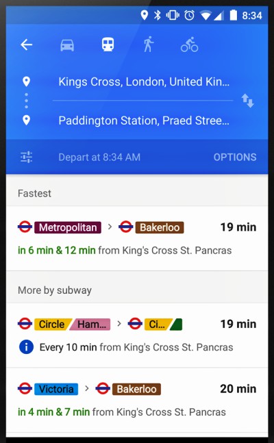
Ever missed a bus? Subway? Yeah, us too. Luckily, Google is making it easier to track your transportation so you can worry less about missing your ride. The Google Maps app now arranges and summarizes relevant journeys, so you’ll know at a glance how long you’ll be waiting for that bus or train and what your other options are if you just miss it. The real-time transit info feature shows you live arrivals for buses, metros and subway systems—and even alerts you to cancelled routes.
 The Google Maps app has also added real-time transit info in two new countries and four new metro areas. Google says it has been working with over 100 transit organizations, and now has an additional 25+ new partners in the UK, Netherlands, Budapest, Chicago, San Francisco, and Seattle.
Google Maps has provided public transit information since 2007, and has grown exponentially since then. Today the app offers schedules from over 6,000 transit authorities, for more than 2.5 million train stations, bus stops, and ferry terminals in over 18,000 cities and towns in 64 countries.
The Google Maps app is included as a default app on Android phones, but if your device doesn’t have it, you can download the latest version from the Play Store. iPhone or iPad users can find Google Maps on Apple’s App Store.
A warning, though: the newest version of the Google Maps app–compatible with the new Android 5.0 “Lollipop”–seems to be causing issues for many users. According to the app’s recent reviewer comments, the latest update has been blamed on increases in wrong directions and even app freezes. Google is no doubt working hard on fixes for those issues.